Passer au contenu principal

The Alta Noguera Pallaresa,


from its source in Val d’Aran to the Borén reservoir in Catalonia

certified in June 2025

News from the Alta Noguera Pallaresa

1er Site Rivières Sauvages européen : l’Alta Noguera Pallaresa

1er Site Rivières Sauvages européen : l’Alta Noguera Pallaresa

24 juillet 2025

The Alta Noguera Pallaresa river basin

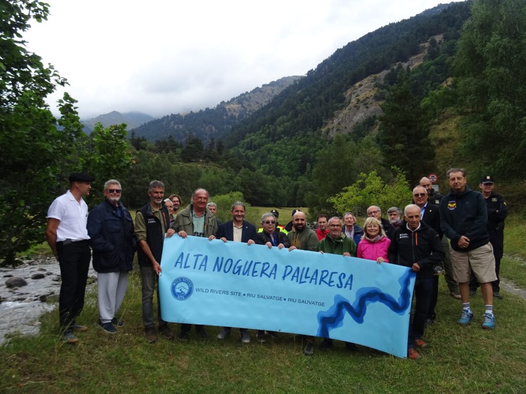
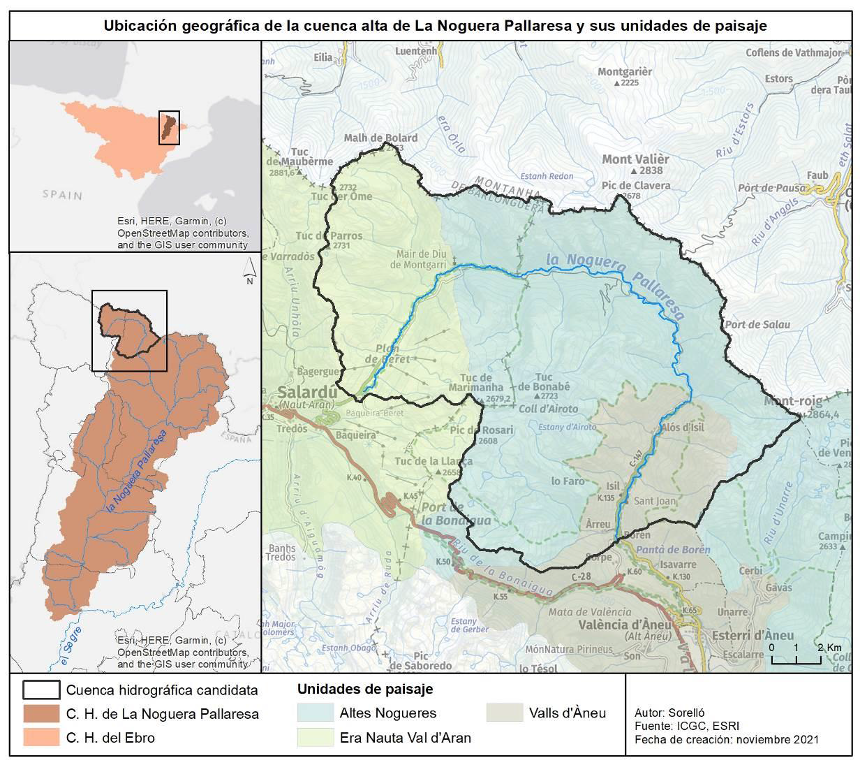
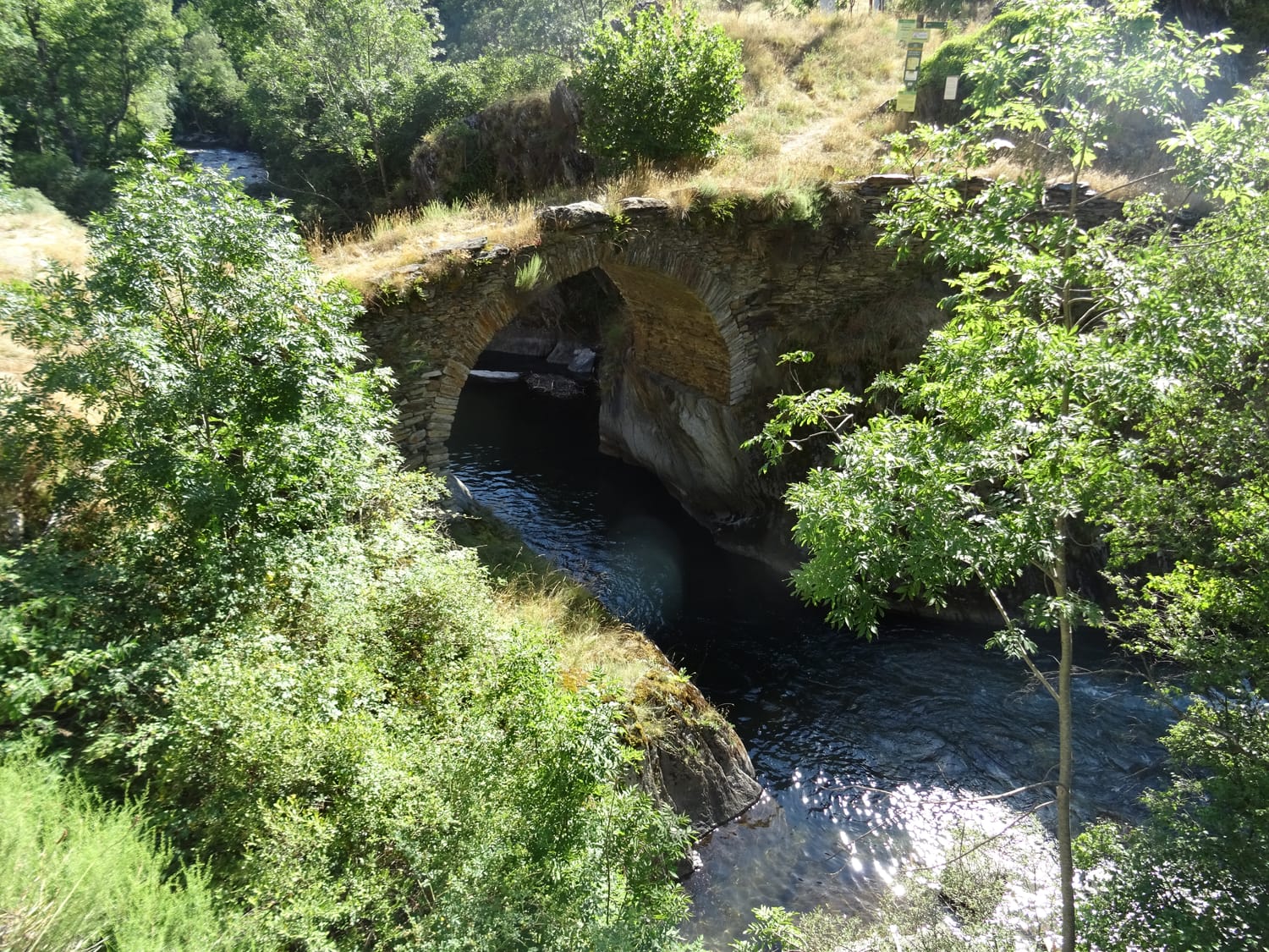
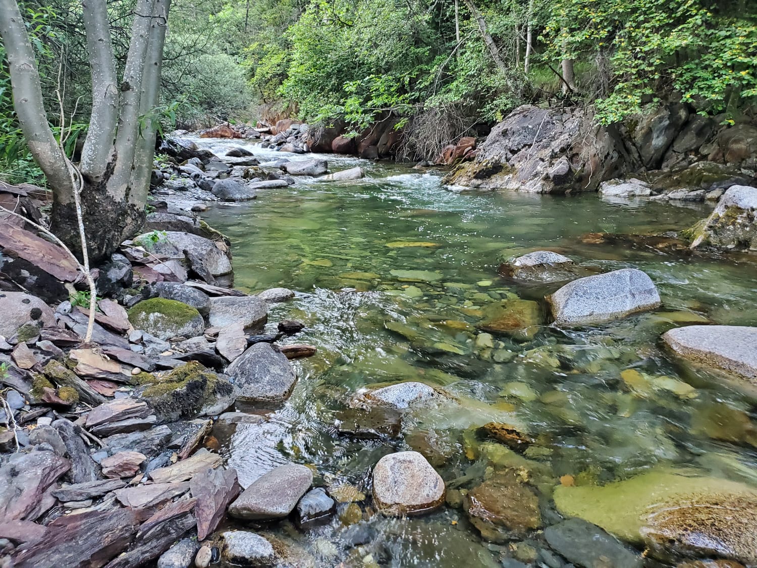
The Alta Noguera Pallaresa, located in the Spanish Pyrenees, is a tributary of the Segre River, which is itself a tributary of the Ebro. The first 10 kilometres of the river are located in the Val d’Aran department, which is responsible for ‘natural environment management’ within its territory. The next 20 kilometres are located in the Alt Pirineu Natural Park, which also has responsibility for this area. On this second section, most of the riverbank plots are municipal pastures, where livestock roam freely. In winter, access is strictly prohibited, while in summer it is mainly hikers on the famous GR11 trail who enjoy the landscape, as this trail winds along the western slope, with a refuge near the river.

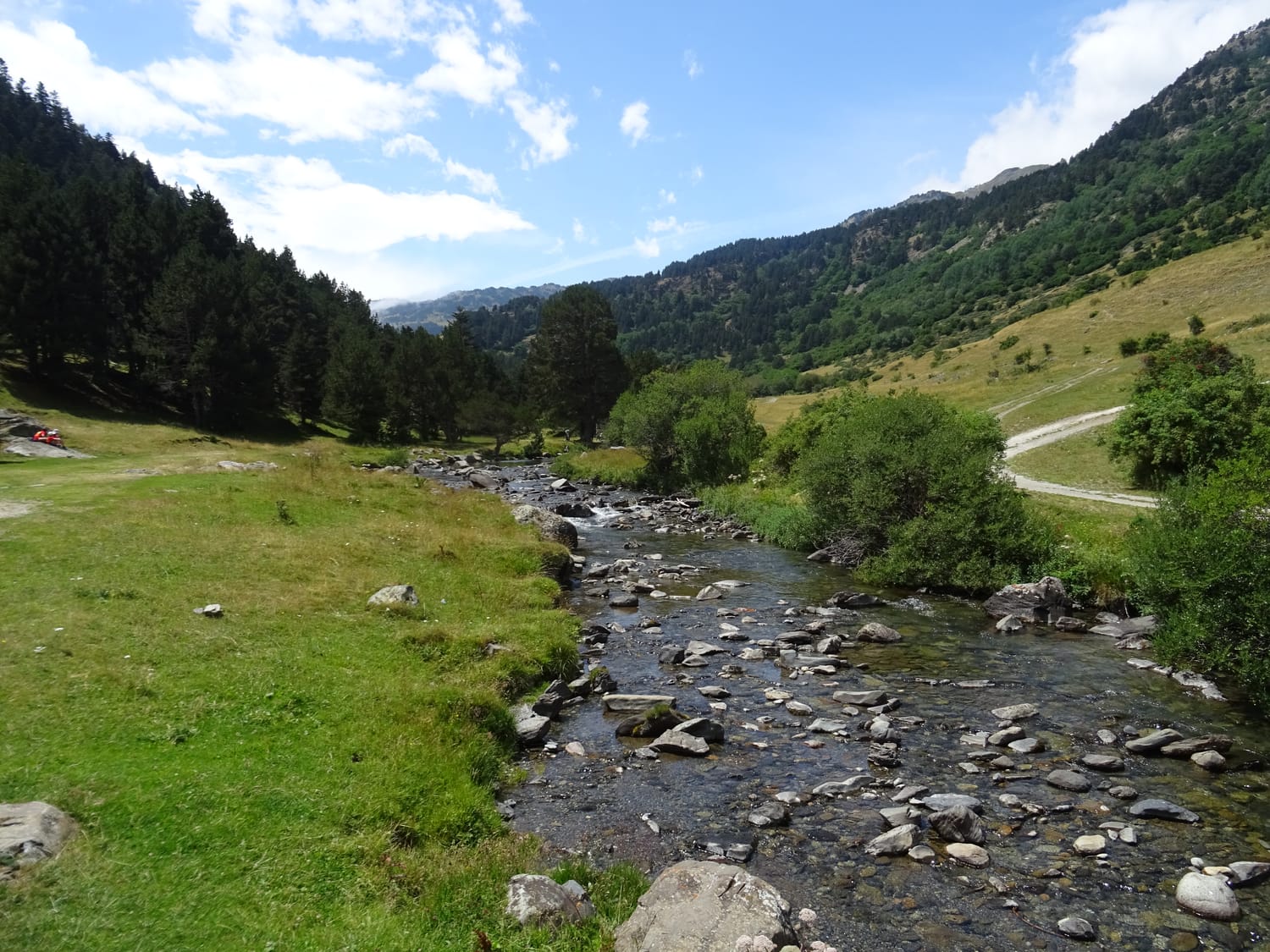
The 32.2 km stretch of the Alta Noguera Pallaresa river is in exceptional condition, with no significant alterations noted in this area, except for the presence of a ski resort located at the head of the watershed. From a fisheries perspective, the entire section is classified as a ‘genetic reserve’ by the Catalan environmental authorities, which prohibits any fish stocking, while the uppermost 22 km of the river are classified as ‘no kill’.

The natural hydrological regime of the basin is of the snow-rain type, with the heaviest rainfall occurring in autumn and spring, and particularly high flow rates during the thaw period between April and June, when the river receives the greatest amount of water. Temperatures are determined by the altitude gradient, with an average of around 4°C at the springs and 8°C at the bottom of the valley. As for precipitation, the average value for the basin is around 1,100 mm/year (with a minimum of 800 mm at an altitude of 1,200 m and a maximum of 1,250 mm at an
altitude above 2,200 m). The prevailing climate in the region is Atlantic.

The wild nature of the Alta Noguera Pallaresa

Physically, it is a mountainous area located in the central Pyrenees, with its highest point being Mont-Roig at 2,864 metres above sea level and its lowest point at the bottom of the valley near the village of Borén at 1,100 metres above sea level. The river rises at Pla de Beret, at an altitude of 1,880 metres. The terrain is mainly composed of siliceous materials, with the exception of the Moredo peak area, which is of limestone origin. Numerous mountain lakes of glacial origin are an important feature of this basin.

The geomorphology of the area is remarkable due to the shaping of the glacial relief, although further upstream at Pla de Beret, the terrain softens to form one of the most extensive areas of flat high mountain pastureland in Catalonia. Following the course of the river, it then enters the Bonabé Valley, characterised by mature fir forests, particularly on the northern slope. Finally, the Alta Noguera Pallaresa runs along the Àneu Valley to the town of Borén. The landscape here is more anthropised, with a mosaic of crops, riverbanks, forests and villages that retain the charm of traditional mountain architecture.

The well-preserved natural characteristics of this environment make it an excellent refuge for emblematic and vulnerable wildlife species such as the brown bear
(Ursus arctos), the capercaillie (Tetrao urogallus) and the bearded vulture (Gypaetus barbatus).

29 actions initiated

A strong partnership has been established between the Alt Pirineu Natural Park in Catalonia and the Aran General Council to support this action programme. All local stakeholders were invited to contribute to its drafting, and the diversity of the parties involved is reflected in the final document: the decentralised municipal entities of Isil i Alós, Gessa and Unha, the municipal councils of Alt Àneu and Nauth Aran, the General Council of Pallars Sobirà, the scientific commission of the Natural Park, the Ministry of Territory, Housing and Ecological Transition of the Government of Catalonia, representatives of local fishing companies, livestock farms and local sports organisations.

Restoration and conservation

1. Diversify and strengthen livestock farming
2. Reconcile livestock farming and river habitats
3. Develop the digitisation of services
4. Strengthen surveillance
5. Standardise fishing regulations in the ‘Site Rivières Sauvages’ area
6. Establish equipment disinfection points
7. Regulate swimming
8. Regulate road traffic
9. Reconcile with motorhome owners
10. Create a trail along the Wild Rivers Site section
11. Inventory, study and promote cultural heritage
12. Implement wastewater treatment systems
13. Drafting and approval of a Beret Use Plan
14. Conservation of the wetlands of the Beret Plan

Monitoring

15. Flow rate
16. Monitoring of the ecological status of the river
17. Installation of counters for people and vehicles
18. Monitoring of the implementation of the Wild Rivers Site label

Communication and awareness raising

19. Promotion and enhancement of the Wild Rivers label
20. Creation of a co-management or co-governance committee
21. Creation of information panels
22. Offering guided tours
23. Dissemination and promotion of the river’s cultural and natural heritage
24. Creation of informational videos
25. Organising school workshops
26. Twinning with other Wild Rivers sites

Local development

27. Developing a local development plan

Shared governance

28. Consolidating the co-governance committee
29. Decision-making model for the co-governance office

Videos

2025, 7′

Communication du Parc Naturel de l’Alt Pirineu à l’occasion de la labellisation de l’Alta Noguera Pallaresa.

Photos : ARRS